Geophysical interpretation supports bedrock modelling and mineral exploration
The Applied Geophysics unit of GTK is strongly directed towards mineral exploration. The unit employs 20 geophysicists, half of whom work mainly with mineral exploration projects. In addition we have an active technical team managing, for example, our geophysical field measurements and the GTK drill core facilities.
Mineral exploration projects are, to an increasing degree, seeking to describe the target or related mineral system with integrated 3D modelling and common Earth models. Various geophysical methods and models, combined with lithological and structural information, can significantly help to visualize the target and identify mineralization indicators. In the future, we’re expecting 3D data mining and prospectivity modelling studies to develop into new tools for the exploration industry. However, as we move from 2D to 3D, or from shallow to deep exploration, we also move from hard evidence (drilling, measured data) to interpreted models. With the complex geology typical of the Finnish bedrock, the accuracy and reliability of models need to be developed to meet the requirements of advanced 3D queries and interpretation. Therefore, modelling processes should be constrained by all available prior knowledge to achieve the best possible results.
Petrophysics: a foundation for successful modelling
Geophysical models depict the distribution of sub-surface physical properties. Understanding the linkage between the physical properties and geology requires knowledge of the physical properties of the target. The knowledge can be obtained from general estimations and literature studies; however, the more complex the target becomes, the more specific and accurate data is needed to support successful integrated modelling.
GTK runs a long-standing petrophysical laboratory for assessing most physical properties from rock samples. Depending on accuracy requirements, petrophysical data can also be acquired through drill hole logging or portable devices. Once the target is petrophysically defined, the data can be used to constrain or guide the modelling to conform to current geological expectations or knowledge. This increases the model’s performance in describing the whole study volume and reduces modelling ambiguity.
Unique databases
Fast access to all available data ensures the efficient integration of geological and petrophysical data into geophysical modelling. For decades GTK has accumulated not only geological but also geophysical data. Our airborne data covering the whole country, national petrophysical database and extensive ground survey database with over 6,000 survey dataset entries are complemented by legacy data, for example, from Outokumpu Oy. The database indices can be viewed in the public Hakku service (https://hakku.gtk.fi/en/locations/search).
Modern modelling and deep-exploration techniques
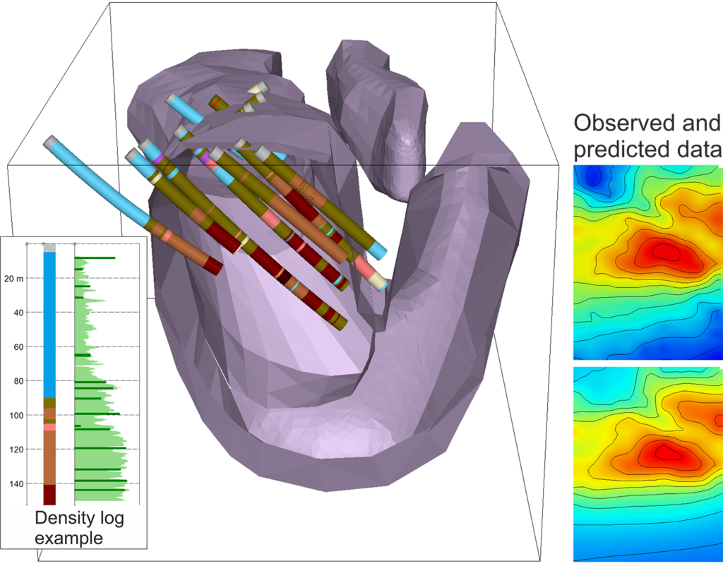
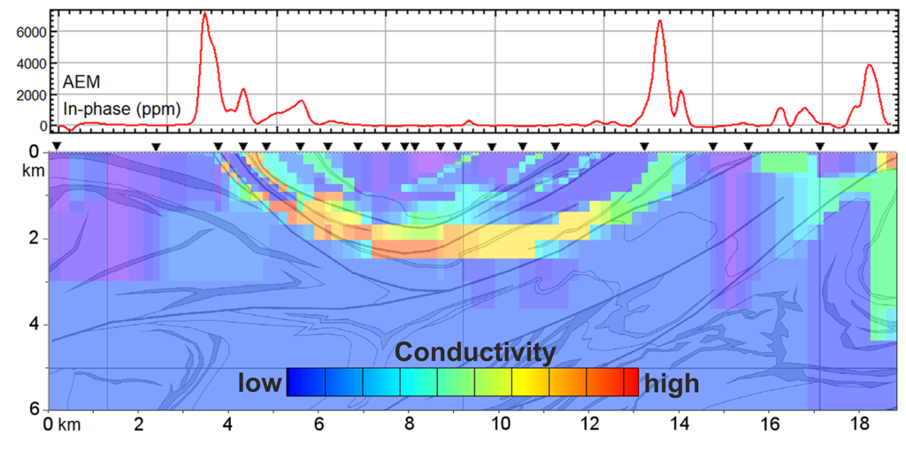
The construction of subsurface property models is based on comparing their predicted geophysical responses to observed data, either using a model built by an expert (forward modelling) or in an automated optimization approach (inverse modelling). The modelling approaches are well established for potential field (magnetic and gravity) data, and modern modelling and inversion tools, e.g. UBC and Geosoft VOXI, along with geological 3D modelling platforms enable compilation of constrained 3D interpretations. However, we also have strong expertise in more complex modelling of most types of electromagnetic data, covering a variety of solutions from thin-plate modelling of standard exploration datasets to rigorous modelling and inversion to generate customized high-quality modelling solutions. GTK is also strongly involved in the development and application of reflection seismic method in crystalline bedrock environments, where interest towards seismic exploration has increased due to technical advances of the past few decades and the method’s unique ability to image deep bedrock interfaces with a high resolution.
GTK’s deep-exploration know-how is constantly developed in scientific and applied projects. Deep-reaching electromagnetics and reflection seismics complemented with, for example, potential field models provide an integrative geophysical modelling approach that can be customized according to requirements.
Text: Hanna Leväniemi