Geophysical Modelling
Geophysical modelling is an effective tool for steering further research, such as plans for future drilling, in the right direction.

A wider view of the properties of the Earth’s crust
Modelling provides more extensive information on the properties of the Earth’s crust than data based merely on measurement lines and data points.
Modelling is a suitable method for various geological studies
Geophysical models can be used, for example, in ore prospecting, planning of rock construction, environmental research, and groundwater studies.
Modelling benefits further research
Modelling is an effective tool for steering further research efforts.
Data collection, processing, modelling and visualisation are key elements when planning further research
Geophysical modelling refers to a numerical model, calculated based on geophysical data, which describes the physical properties and structure of the soil. Each property and depth range depend on the applied measurement method and the way the measurements are performed. GTK offers modelling services for data that is either based on its own measurements or derived from other studies. The models are two or three-dimensional, and the scale is selected according to the target and available data. The service involving interpretation and modelling of regional data is introduced separately on its own page.
Contents of the geophysical modelling service:
- Collection and processing of geophysical data and supporting regional information
- Modelling the results of different geophysical methods
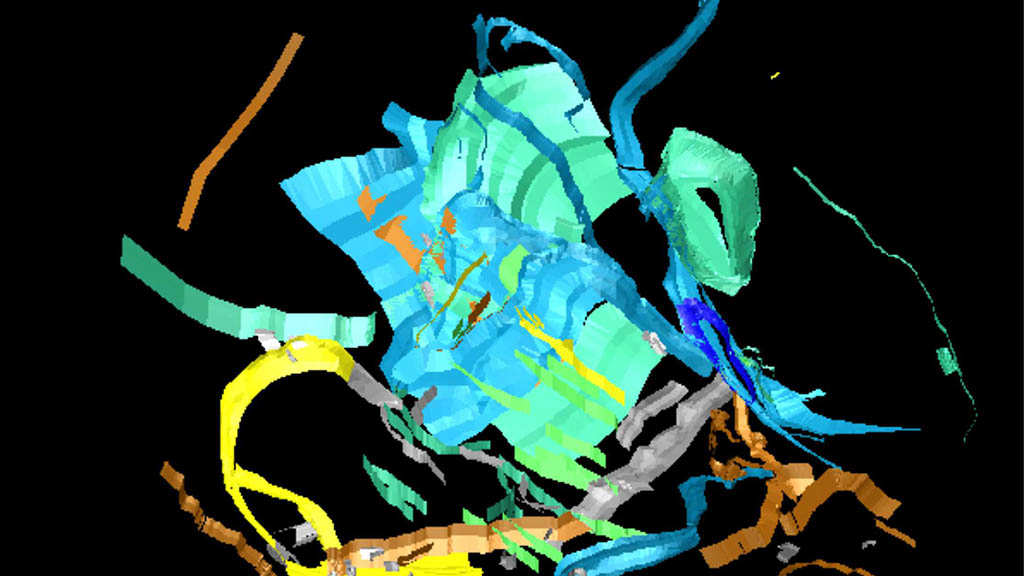
- 3D-visualisation
- Shared use of data
GTK’s wide-ranging expertise and extensive selection of geophysical methods ensure the accuracy of the modelling service.
Geophysical modelling services are well-suited for various geological studies.
Contact us
Leave your contact information and we will get back to you.
Contact our expert