Nationwide database of glacial features is publicly available
A new, nationwide database of glacial features in Finland is now publicly available via GTK’s spatial data products service. Understanding of glacial features provides a significant contribution across several fields in society, including groundwater management, land-use planning, natural resource exploration, forestry and the protection of groundwater, the environment and natural diversity.
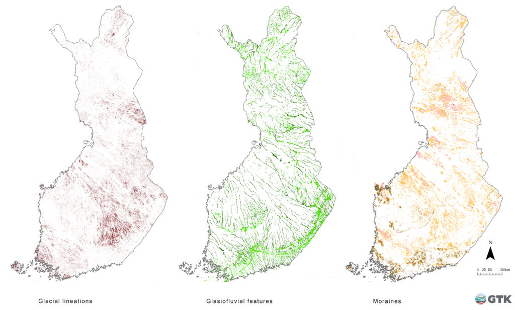
The glacial features database produced by the Geological Survey of Finland (GTK) has been expanded to cover the whole country. The database includes the typical landforms existing in glaciated regions such as eskers and ice-marginal glaciofluvial deposits, hummocky moraines and their sub-types, ice-marginal moraines, and drumlins and flutings.
Glacial features were mapped through the geological interpretation of LiDAR-based digital elevation models provided by the National Land Survey of Finland. The interpretation was supported by existing datasets, including Quaternary geology maps, geological outdoor maps and Quaternary, soil aggregate and groundwater research reports, as well as bedrock outcrop data, borehole data and geophysical surveys. Aerial photographs and the Topographic Database provided by the National Land Survey of Finland served as complementary assets in the mapping project.
The new database expands existing mapping data to areas that previously lacked precise information on superficial deposits and glacial landforms. This information is needed, for example, in groundwater studies, land-use planning, mining feasibility studies and environmental impact assessments, natural resource exploration, and protection of the environment and natural diversity.
Knowledge of the ice-flow direction and intensity, as indicated by glacial lineations, is widely used in mineral exploration and in studying past glacial environments. Understanding of glacial dynamics and glacial history is fundamental to paleo-glaciological reconstructions, which are used as analogies in contemporary climate change research. The new glacial features database is also well suited to educational purposes and offers an insight into past glaciations for anyone interested in the geological history of Finland.
Features mapped in the glacial features database can be downloaded in vector form via the Hakku web service. The database includes approximately 200 000 polygon features and over 300 000 glacial lineations.
The glacial features database will be updated by late 2021. The database has previously been referred to as the Glacier Dynamic Database (Putkinen et al. 2017).
Further information
Senior Scientist Jukka-Pekka Palmu, Information Solutions, jukka-pekka.palmu@gtk.fi, tel. +358 29 503 2575
GTK`s Data sets and Online services