Nationwide Mapping of Mining Environments Reveals Regional Differences in Natural Soil Geochemical Baselines
The Geological Survey of Finland GTK has mapped soil geochemical baselines in mining environments and in areas of mineral exploration interest across Finland. Baseline data enable the distinction between natural geochemical variation and contamination caused by human activities, which is a fundamental prerequisite for all land use planning. The results of this multiyear nationwide survey are compiled here by region.
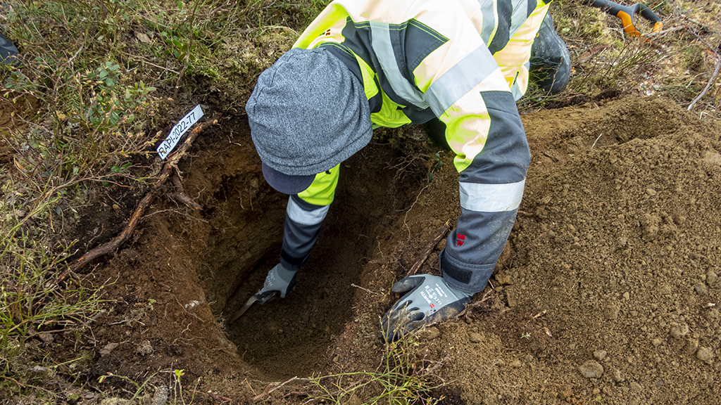
GTK has conducted geochemical baseline mapping of soils at a total of 23 sites across Finland by collecting soil samples from environments surrounding mines and from areas of mineral exploration interest. The studies were carried out as part of GTK’s self-financed nationwide geochemical baseline mapping programme in 2016–2023. The goal of this comprehensive survey across Finland was to investigate and compile data on typical concentrations of numerous elements in soils.
Soil’s geochemical baseline refers to the natural levels of potentially harmful substances, or naturally elevated concentrations that occur over wide areas without contamination caused by human activities. Geochemical baselines reflect the bedrock, soil characteristics, and geological history of the area. In other words, elevated concentrations of metals and arsenic in soil occur naturally due to local geological conditions. In mining environments, soil samples were collected from areas not affected by mining activities.
Assessing soil status requires baseline data
Information on naturally elevated concentrations of metals and arsenic is particularly important in assessing soil status. The Finnish Government Decree on the Assessment of Soil Contamination and Remediation Needs (214/2007), known as the PIMA Decree, defines threshold and guideline values for harmful substances. According to the Decree, in areas where naturally elevated baseline concentrations exceed the specified threshold value, regional baseline values may be used in place of the threshold in assessments.
Regional (i.e. calculated) baseline value refers to a statistically derived value representing the natural concentration of a given element in soil in a particular area. It is not a single measurement, but a representative value calculated from multiple soil samples.
In GTK’s studies, soil samples were collected from glacial till at two depths: the topsoil and unaltered subsoil at a depth of less than one metre. Aqua regia-extractable concentrations of approximately 43 elements were analysed. The results have been stored in GTK’s Geochemical baselines map service, which provides open access to nationwide data.
The results of the baseline mapping can be utilised in environmental investigations and land use planning and management. Baseline concentration data enable differentiation between typical regional geochemical variation and impacts caused by human activities. Detailed results for each study area have been published in GTK Open File Work Reports, available in the Hakku data service.
Naturally elevated arsenic concentrations in Jokisivu and Orivesi
In Southern Finland, at the Jokisivu (Huittinen) and Orivesi study sites, the baseline concentration of arsenic in soil was found to exceed the established threshold value. Based on these results, regional baseline concentration for arsenic can be applied instead of threshold values in soil status assessments in these areas.
The study also shows that threshold values for other analysed metals were not exceeded in topsoil or subsoil samples.
Locally elevated arsenic concentrations in Eastern Finland
In Eastern Finland, mapping was conducted at Kylylahti (Polvijärvi) and at Pampalo and Rämepuro (Ilomantsi). The results indicate regional variation: concentrations of harmful metals and arsenic were typical in Kylylahti, whereas arsenic concentrations in Pampalo and Rämepuro exceeded threshold values.
In Pampalo and Rämepuro, calculated baseline concentration values may therefore be used in place of threshold values for arsenic in soil assessments. Threshold values for other metals were not exceeded in topsoil or subsoil samples.
Elevated arsenic concentrations in the Kaustinen area
In Central Ostrobothnia, mapping was carried out in the Kaustinen area. The results show that the baseline concentration of arsenic in soil exceeds the threshold value. Consequently, calculated baseline concentration values may be used instead of threshold values for arsenic in soil status assessments. Threshold values for other analysed metals were not exceeded in topsoil or subsoil samples.
Locally elevated metal concentrations in Northern Ostrobothnia and Kainuu
In Koillismaa and Kainuu, mapping was conducted at seven study areas: Juomasuo–Hangaslampi and Maaninkavaara (Kuusamo), Peura-aho and Hietaharju (Suomussalmi), Sotkamo, Mieslahti (Paltamo), Mustavaara (Taivalkoski), and the Raahe area.
The results show regional variation. Baseline concentrations of harmful metals and arsenic were typical in the Juomasuo–Hangaslampi, Maaninkavaara, Mustavaara, Sotkamo, and Raahe areas.
In Peura-aho and Hietaharju, soil contains chromium and nickel at concentrations exceeding threshold values. In addition, nickel exceeds the threshold in Mieslahti. In these areas, calculated baseline concentration values may be used in place of threshold values for the respective metals. Threshold values for other metals or arsenic were not exceeded in topsoil or subsoil samples.
Extensive and diverse geochemical variation in Lapland
In the Lapland region, mapping was conducted at nine study sites: the Kemi–Keminmaa area, Suhanko (Ranua), Hannukainen (Kolari), Kuotko (Kittilä), Ikkari, Pahtavaara, Sakatti and Kevitsa (Sodankylä), and Sokli (Savukoski). The results indicate significant regional variation. In Hannukainen, Suhanko, and Kemi–Keminmaa, baseline concentrations of harmful metals and arsenic were typical, whereas in other areas several concentrations exceeded threshold values.
At the Ikkari mineral exploration site, arsenic baseline concentrations exceed the threshold value. In Sakatti, chromium and nickel are elevated, and in the Kevitsa mining area cobalt is also elevated. In the Pahtavaara mining environment, arsenic, cobalt, chromium, nickel, and vanadium are elevated. In Kuotko, arsenic, cobalt, copper, nickel, and vanadium exceed threshold values. In Sokli, cobalt and nickel occur at higher than typical concentrations in soil.
In the Ikkari, Sakatti, Kevitsa, Pahtavaara, Kuotko, and Sokli areas, calculated baseline concentration values may be used instead of threshold values for the metals and arsenic exceeding these thresholds.
Further information
Raija Pietilä, Geologist (available until 3 August)
Geological Survey of Finland GTK
raija.pietila@gtk.fi
Tel. +358 29 503 4253
Tarja Hatakka, Geologist (available from 6 July)
Geological Survey of Finland GTK
tarja.hatakka@gtk.fi
Tel. +358 29 503 2186
The results of the nationwide survey are available in GTK’s Geochemical baselines map service:
Go to the Geochemical baselines map service
All the Open File Work Reports of the nationwide mapping are available in Finnish in GTK’s Hakku data and download service:
Go to the Hakku service
Information on GTK’s service:
Soil Geochemical Baselines