The Ground Investigation Service Compiles Data for Construction Design
Ground investigations are conducted every time something is built. They help to identify ground conditions and to select the most appropriate foundation method. The data storage method varies from one municipality and organisation to the next. For ten years now, the Geological Survey of Finland (GTK) has stored and distributed ground investigation data provided by municipalities and other public organisations free of charge through its Ground Investigation Map Service. Most ground investigations are obtained from the Finnish Transport Infrastructure Agency’s construction and renovation projects.
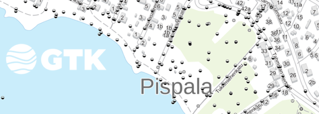
Currently, the service consists of nearly 700,000 ground investigations, with roughly 39,000 new investigations having been saved this year. In this context, ground investigations mean point-like research data: either drilling, a test pit, sample or water level measurement. Documented ground investigation data saved in standard format offers a good starting point for new designs so that resources can be allocated to locations that have yet to be surveyed. The Ground Investigation Service’s datasets can be viewed in the service or downloaded for personal use.
GTK has surveyed Finnish soil for decades. As a rule, surveys have been conducted at a depth of one metre. Ground investigations supplement surficial geology map data by adding a new depth dimension, especially with regard to clay and silt layers that are challenging for construction. GTK sees that ground investigations provide valuable information about the ground conditions that everyone should be able to access.
Documented ground investigation data saved in standard format offers a good starting point for new designs so that resources can be allocated to locations that have yet to be surveyed.
GTK is currently developing new features for the service with constructors in the public sector. New services under development include the sulphate and corrosion analysis and aggregate analysis databases. We are also seeking municipalities to produce new ground investigation data as partners.
Testing New Measurement and Sampling Methods in Hiekkaharju
Hiekkaharju and Hakkilanharju eskers surround the large clay basin between Hiekkaharju, Koivukylä, Hanaböle and Satomäki in Vantaa, through which the Keravanjoki river flows. These eskers were formed by a subglacial river when the last continental ice sheet retreated. Unlike many steep-sloped inland eskers, coastal area eskers have more gentle slopes as they were affected by sea and lake stages that washed and lowered the eskers. In Hiekkaharju, you may not even notice that you are moving around in an esker formation.
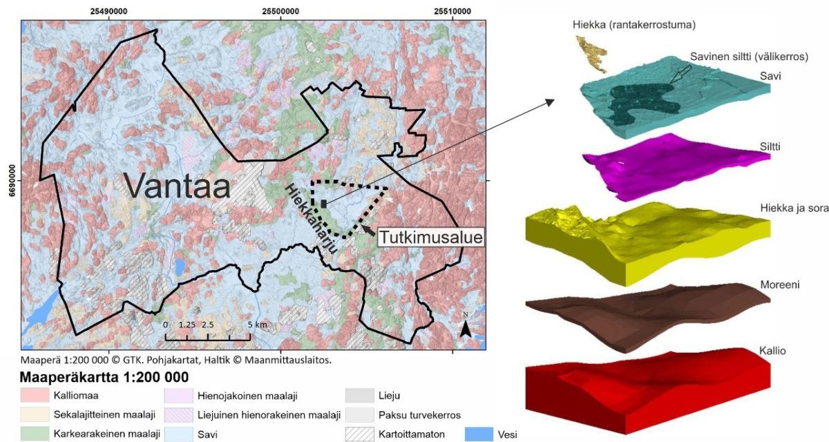
Hiekkaharju modelling at GTK is associated with the larger 3DSuomi project, the goal of which is to illustrate soil and bedrock structures in different areas in three dimensions instead of more conventional 2D visualisations. The subsurface geological models produced in this way can be used on 3D design platforms. The purpose of modelling Keravanjokilaakso, a clay-covered river valley on the north-eastern side of Hiekkaharju, is to investigate the distribution of the sand and gravel deposits covered by clay, and to produce a detailed representation of the area’s subsurface layers. Some 3,300 ground investigations produced by the City of Vantaa have been used in the interpretation.
Other previous surveys conducted in the area include gravity measurements to determine the topography of the bedrock surface, electrical resistivity tomography (ERT) to expand the topography of the bedrock surface, and the interpretation of subsurface geology. The survey area also acted as a test site for GTK’s new seismic equipment and sand sampling beneath the clay layer. Surveys were targeted using a preliminary subsurface geological model and conducted in cooperation with the City of Vantaa.
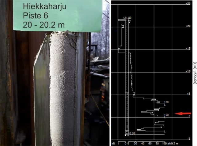
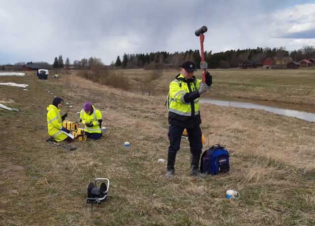
GTK’s seismic equipment was tested in the clay area on the north-eastern side of Hiekkaharju in the spring of 2021. During the measurements, the ground motion caused by a hammer’s impact, i.e. seismic waves, was measured using 80 modern wireless receivers (geophones). The speed of seismic waves provides information about the composition of soil, and reflected waves serve to determine the depth and position of boundary layers, as well as any depth variation in the bedrock surface. The seismic waves caused by the hammer’s impact provide information about subsurface down to a depth of dozens of metres.
A 3D Model of Hiekkaharju as the Goal
According to preliminary results, the area features large continuous deposits of sand and gravel covered by clay. Redeposited sand and silt layers have also been discovered in clay depressions next to Hiekkaharju as thin intermediate layers and at the edges of eskers as shore deposits on top of clay. The use of seismic methods when conducting soil surveys in an urban area is one of the most important areas of development at GTK. With new wireless equipment based on the GPS technology, measurements can be conducted flexibly in various environments. By combining seismic data with accurate data provided by ground investigations of soil layers, and by measuring crosswise profiles, a 3D subsurface geological model can be generated in place of 2D cross-sections.
Further Information
Geologist Hilkka Kallio, Energy and Construction Solutions, Geological Survey of Finland, hilkka.kallio@gtk.fi
GTK`s Ground Investigation Map Service (In Finnish)