European Research Collaboration Paved the Way for Improved Contaminated Soil Management
Soil contamination is a major environmental challenge across Europe. Geological Survey of Finland GTK coordinated the ISLANDR project which developed tools for identifying sources of contamination, assessing risks, managing land use risks, and evaluating the financing and effectiveness of remediation measures. Key outcome of the project is a roadmap that brings together the different stages of contaminated land management and supports sustainable, risk-based land use planning and decision-making.
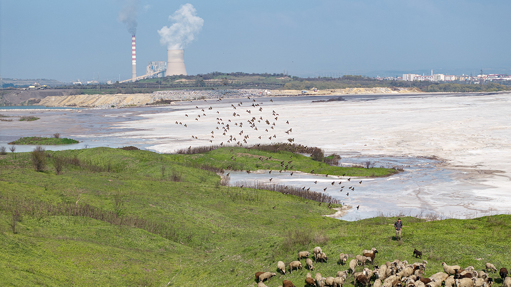
According to estimates, 60–70% of soils in European Union member states have been altered to some extent as a result of human activities. Safeguarding soil health requires comprehensive information on soil conditions, as well as effective tools for managing contaminated land and land use.
“The results of the ISLANDR project have been compiled into an online roadmap that integrates the stages of contaminated land management and the tools that support them. The roadmap presents the typical sequence of activities involved in managing contaminated land, from site identification to land use and remediation method selection, as well as implementation, maintenance, and monitoring,” says Timo Tarvainen, Scientific Coordinator of the project at GTK.
The roadmap includes three pathways. The most detailed pathway focuses on individual contaminated sites. The second pathway addresses portfolios of contaminated sites, while the third deals with widespread soil contamination caused by diffuse pollution. The tools linked to the different stages of each pathway support users throughout the planning process and facilitate the selection of sustainable solutions.
Metadata catalogue and contaminants of emerging concern
One of the project’s key achievements is a metadata catalogue covering all EU member states. For the first time, it provides a Europe-wide overview of soil contamination-related datasets and data management practices across member states. Significant differences exist between countries in terms of data availability and management practices. The metadata catalogue will serve as a valuable resource for the future development of soil monitoring systems and the effective use of soil-related information.
As part of the project, the French Geological Survey (BRGM) carried out a prioritisation of Contaminants of Emerging Concern (CECs). At contaminated sites, harmful substances may occur at concentrations that pose risks to groundwater, the environment, and soil functions. Well-known contaminants are generally considered effectively. However, many potentially harmful substances are not monitored and their impacts on soils are not yet understood. The study assessed contaminants according to their potential significance and examined which substances should be systematically monitored within soil monitoring programmes.
European collaboration and lessons from test areas
The project involved close collaboration with stakeholders as well as other Mission Soil projects funded under the Horizon Europe programme. Cooperation also took place with the European Soil Observatory (EUSO), the main European platform for collecting and disseminating soil information. The shared objective was to support the implementation of the EU Soil Mission, which requires comprehensive knowledge of current practices and soil health-related data.
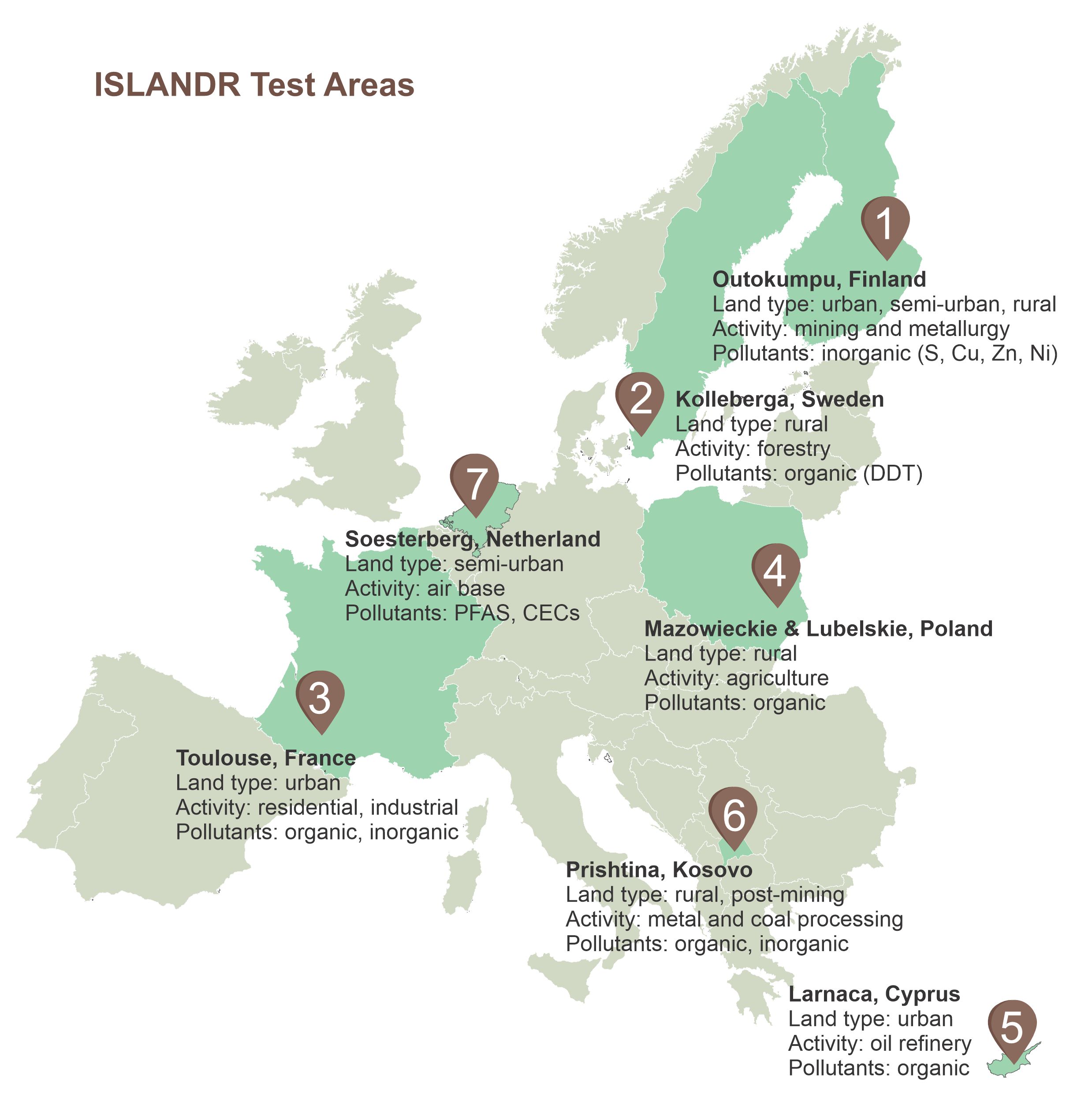
The seven ISLANDR test areas across Europe represented different contamination types and operating environments. Most of all, the test areas generated stakeholder-driven knowledge on the challenges posed by soil contamination and the types of solutions required in different contexts. These findings were used in the design of the tools and operational models developed within the project.
Remediation impacts examined beyond economic benefits
“The project developed innovative financing models to promote remediation activities. Alongside economic factors, we also examined the broader impacts of remediation measures, such as environmental amenity and long-term benefits that cannot be directly expressed in financial terms,” says Tarvainen.
Contaminated sites differ considerably in both the extent of contamination and the types of pollutants present. Land use pressures, legislation, management practices, and funding opportunities also vary from region to region, influencing the feasibility of remediation measures. In densely populated areas, land values are often high enough to make remediation economically viable. Elsewhere, greater support may be required, particularly for so-called orphan sites where no responsible party can be identified.
The research explored how the wider benefits and adverse impacts of remediation measures could be assessed more effectively. Such effects are often difficult to translate into direct financial gains or losses for landowners. Their impacts may only materialise over the long term, for example through improved local amenity or increased property values. The project therefore examined stronger integration between land use planning and soil remediation, as well as the policy objectives associated with remediation activities.
Outcomes for contaminated soil management
The ISLANDR project generated a wide range of knowledge and tools to support the development of soil remediation strategies. Key outputs include risk assessment tools, data analysis algorithms, guidance materials, policy briefs, financing and planning models, and datasets.
Most of these outputs support Sustainable Risk-Based Land Management (SRBLM) and remediation practices. The developed risk assessment models incorporate soil health considerations, representing a novel feature. The goal is to maintain soil functions at the best possible level. A critical aspect of risk assessment is determining the extent of contamination, namely whether it concerns a single contaminated site or large-scale soil contamination caused by diffuse pollution.
Further information
Timo Tarvainen, Scientific Coordinator
Geological Survey of Finland GTK
timo.tarvainen@gtk.fi
Nike Luodes, Project Coordinator
Geological Survey of Finland GTK
nike.luodes@gtk.fi
Tel. +358 29 503 3529
All project results and outputs will be available on the ISLANDR project website: Information-based Strategies for Land Remediation
The three-year Horizon Europe-funded ISLANDR project brought together organisations from 13 European countries. The project developed novel datasets, assessment methods, and planning tools that support the integration of soil health considerations into land use planning and the implementation of the EU Soil Directive in member states. In Finland, the project partners were GTK and the Finnish Environment Institute (Syke).