Mapping of Shallow Marine Areas Reveals New Insights into Seabed Conditions in the Gulf of Bothnia
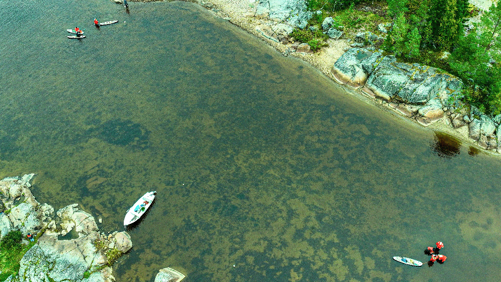
The shallow marine areas of the Gulf of Bothnia are vital to the health of the entire marine environment, not least because of their high biodiversity. However, these areas are changing rapidly due to land uplift, climate change and increasing human activity. One of the key challenges in sustainable use and marine planning is the lack of data.
There is a particular shortage of geological and biological data for shallow marine areas, even as the need for up-to-date and comprehensive datasets continues to grow.
The Geological Survey of Finland GTK mapped seabed conditions in shallow coastal waters of Finland as part of the joint Finnish–Swedish SeaMoreEco project. Geologists and marine biologists from both countries worked together to study the sensitive environments of the northern Gulf of Bothnia.
The aim was to develop and test methods for monitoring, protecting and restoring shallow-water habitats. The project also advanced new data production processes and methodologies, for example for generating modelled, comprehensive seabed maps.
Especially noteworthy results were achieved by integrating satellite, drone and shipborne acoustic survey data. Combining these datasets made it possible to produce maps of seabed sediments and bathymetry across the entire shallow-water zone from the shoreline to deeper areas. This provided new information on the so-called “white ribbon zone” (0–5 metres depth), which has traditionally been poorly represented in maps.
New datasets reveal previously unknown seabed features
Satellite-derived bathymetry proved to be accurate, enabling water depth estimation down to approximately three metres and the detection of seabed formations such as sandbars. However, the accuracy of satellite data decreases in turbid or deeper waters. In deeper areas, detailed mapping of geological structures and habitats—including areas covered by underwater vegetation—still relies on acoustic measurements conducted from research vessels or other platforms such as unmanned surface vehicles (USVs).
The studies also identified underwater dunes and other features shaped by erosion and deposition from currents, highlighting the highly dynamic nature of seabed conditions. This information supports large-scale monitoring of coastal zone dynamics, land uplift and morphological changes. In addition, improved knowledge of seabed sediments and their properties enhance the ability to assess the impacts of activities, such as dredging and construction of the seabed, to marine life and water quality.
This refined information will benefit municipalities, regions, businesses, and marine spatial planning authorities. Private boaters, fishers and water sports enthusiasts can also utilise the data.
Cross-border cooperation accelerated research and laid the groundwork for future research
The success of the SeaMoreEco project was based on broad collaboration. In Finland, GTK worked closely with the Economic Development Centres of South Ostrobothnia and Northern Finland. In Sweden, partners included the Geological Survey of Sweden (SGU) and the County Administrative Boards of Norrbotten and Västerbotten. Cooperation between GTK and SGU was particularly valuable, as it enabled marine geological systems to be examined beyond national borders.
SeaMoreEco was launched in 2023 and concluded at the end of 2025. The project had a total budget of €3 million and was funded by the EU’s Interreg Aurora programme, the Swedish Agency for Marine and Water Management, and the Regional Council of Lapland. The mapping work made use of the research infrastructure of Finland’s marine research network FINMARI, including GTK’s research vessel Geomari and the survey boat Gridi.
Further research is already underway. A new Interreg Aurora project, Habitat Investigation in Diverse and Dynamic Estuarine Networks (HIDDEN), started in early 2026. In this project, GTK collaborates with SGU, the County Administrative Boards of Norrbotten and Västerbotten, the Economic Development Centres of South Ostrobothnia and Northern Finland, and the Natural Resources Institute Finland (Luke).
Results and further information
Aarno Kotilainen, Research Professor
Geological Survey of Finland GTK
aarno.kotilainen@gtk.fi
Meri Sahiluoto, Geologist
Geological Survey of Finland GTK
meri.sahiluoto@gtk.fi
Results, research reports and datasets are available on the SeaMoreEco project website:
SeaMoreEco results
Results of GTK’s and SGU’s marine geological mapping are presented in more detail in the project report available on the website:
Seabed Mapping in the Shallow Waters of the Gulf of Bothnia – A Joint Finnish–Swedish Initiative for the Management of Shallow Habitats.
Francis Freire, Tarikul Islam, Aarno Kotilainen, Elina Lindsberg, Meri Sahiluoto, Olli Sallasmaa, Peter Slagbrand, Riku Olli Valta, Anton Wagner, Pichaya Zerne (2025). SeaMoreEco Technical Report WP2, 106 pp. Doria.